Mw 8.8 KAMCHATKA PENINSULA on July 29th 2025 at 23:24 UTC
Last update: 19 September 2025 at 07:55 UTC
Earthquake details | Seismic information | Aftershocks locations
Eyewitnesses data | Send us pictures or videos
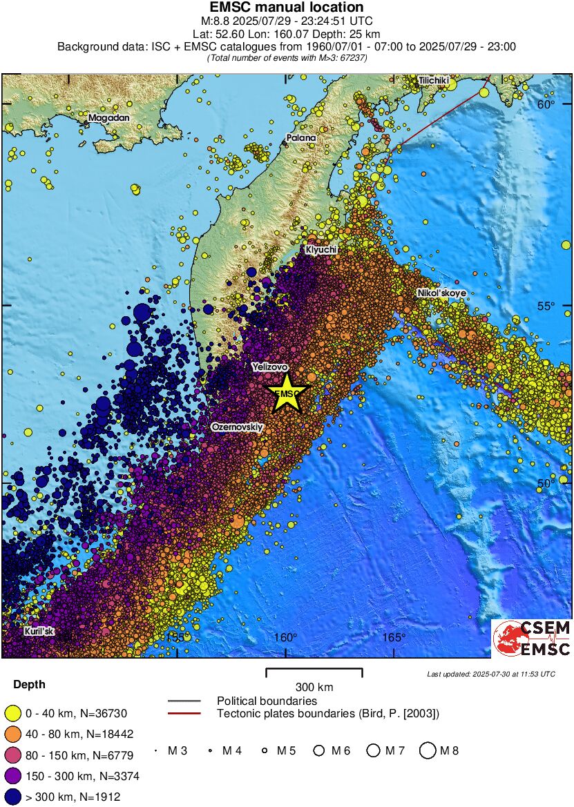
On July 29, 2025, at 23:24 UTC (July 30, 2025, at 11:24 a.m. local time), an earthquake of magnitude Mw 8.8 occurred off the eastern coast of the Kamchatka Peninsula, 110 km from Petropavlovsk-Kamchatsky, Russia. This is the eighth largest earthquake recorded globally! Seismological information is available here.
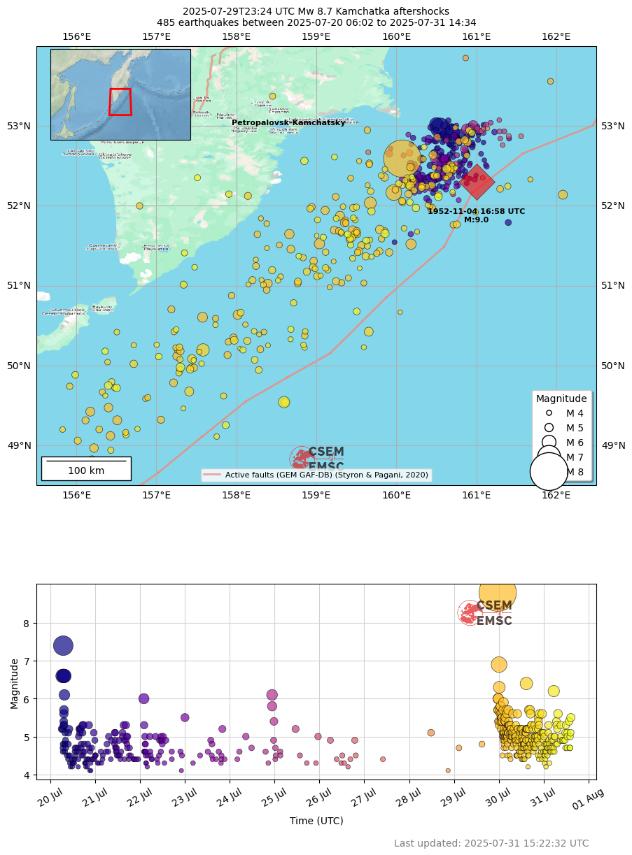
This M8.8 was preceded nine days earlier by a M7.4 on July 20, occurring nearby and on the same subduction interface. Seismological information is available here
After the Mw 8.8, a tsunami alert has been issued for the Pacific Ocean.
Following the Mw 8.8, two major aftershocks have struck the region:
- On September 13, 2025, at 02:37 UTC, a Mw 7.4 earthquake occurred at 46 km depth. More info here.
- On September 18, 2025, at 18:58 UTC, a Mw 7.8 earthquake occurred at 30 km depth. More info here.
In total, since the beginning of the crisis, more than 1,490 aftershocks have been recorded
This region is seismically active, experiencing high-magnitude earthquakes, such as the Mw 9 earthquake that occurred on November 5, 1952 (Fig. 1).
If you felt this earthquake, please share your experience with us. Your testimony will be useful for updating the Intensity map here below, where the felt intensities represent the effects of the earthquake over the impacted area.
 |
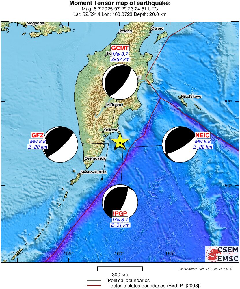 |
| Past Regional Seismicity as from the ISC catalogue (1964-2004) and EMSC Real Time catalogue (2005-today) | Moment tensors solutions received at EMSC |
 |
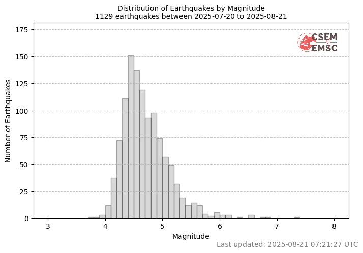 |
| Figure 1: Spatial and temporal distribution of the seismic activity in the Kamchatka region. Purple dots represent the oldest earthquakes in the series, while yellow dots represent the most recent earthquakes. The size of each dot is related to the magnitude of the earthquake. The black circle is the location of the 1952 M9 earthquake. | Figure 2: Distribution of earthquakes by magnitude where Vertical bars represent the number of earthquakes inside each 0.1 magnitude interval. |
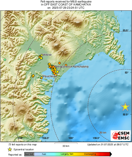
- Map of felt reports
The EMSC collects testimonies from people who felt the earthquake. This information is collected through the LastQake mobile application, mobile or desktop website. The map below shows the testimonies collected by the EMSC for the main shock. Each coloured dot corresponds to a witness observation, which we call a "felt report". The redder the dot, the more intense the earthquake was felt.
By aggregating the reports, we can quickly map the effetcs of the earthquake.
|
|
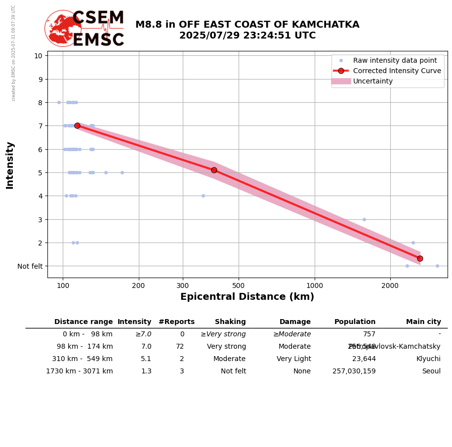
- Curve Intensity / Distance
This graph shows the change in intensity as a function of distance from the epicentre. Intensity ranges from 1 to 12 and measures the observed effects of the earthquake in terms of shaking and damage at a given location. An earthquake is therefore associated with one magnitude and a variety of intensities, depending on where it is observed. For example, we can see that at a distance of 300 km from the epicentre, the average intensity is around 5.5. Moreover you can notice the general trend that the further you are from the epicenter, the less intensively you feel the earthquake.
 |
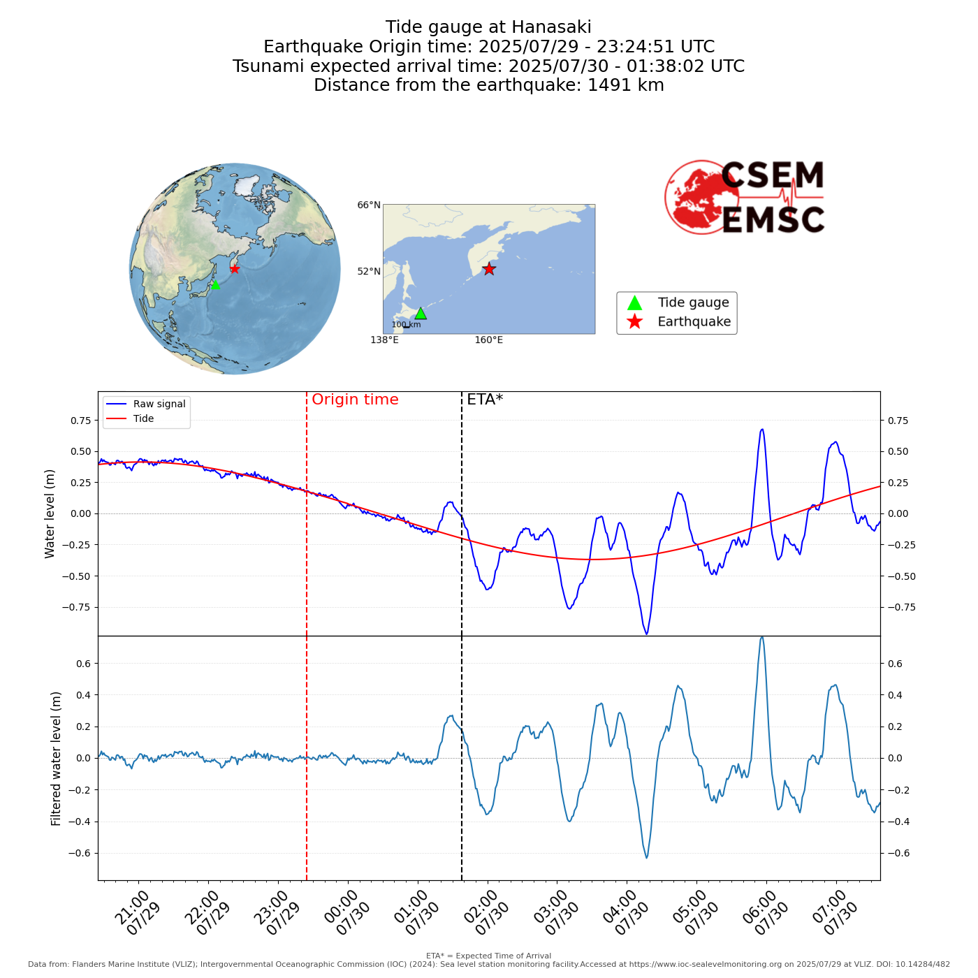
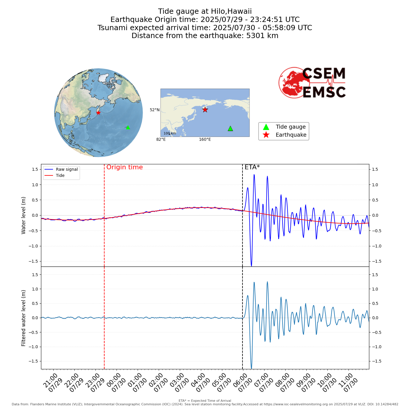
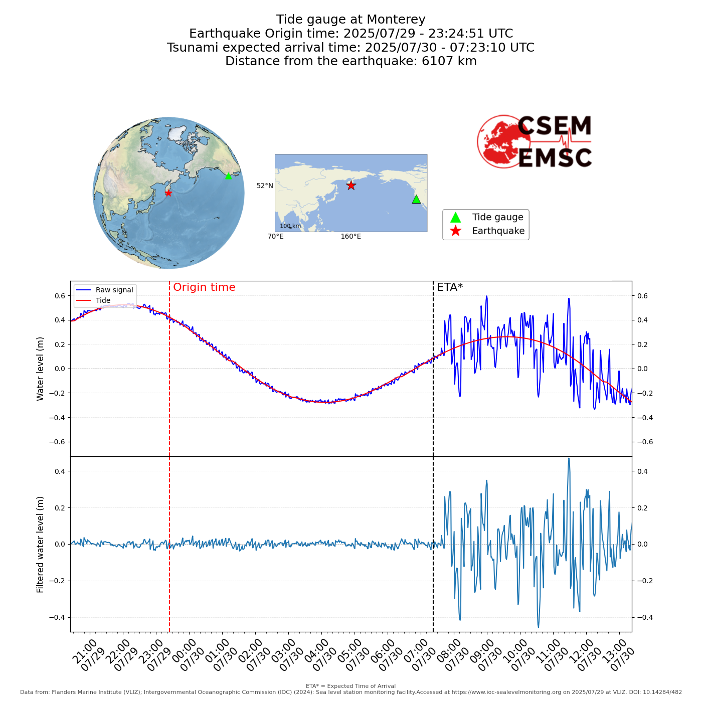
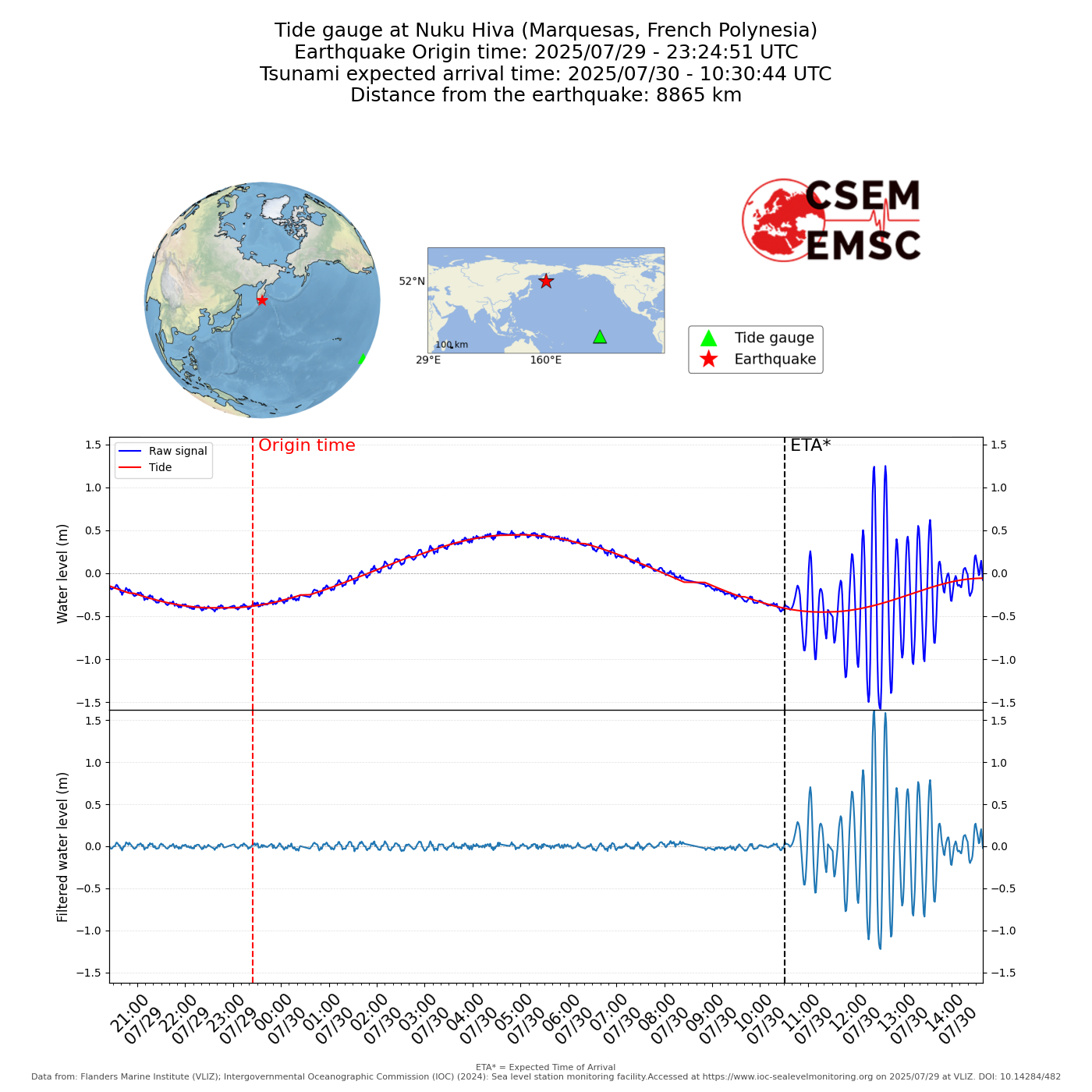
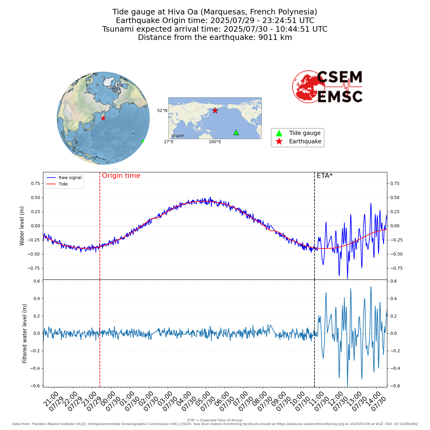
This earthquake has triggered a tsunami alert across the entire Pacific Ocean. Tsunami waves have been recorded in multiple locations, including Russia, Japan, Hawaii, Alaska, and as far as the California coast.
In Hawaii, wave amplitudes have exceeded 2.5 meters. Along the U.S. West Coast, the tsunami was also clearly observed, with wave heights reaching up to 80 centimeters in Monterey, California. These observations confirm that the tsunami propagated across the entire Pacific basin, impacting coastal regions thousands of kilometers from the epicenter.
Monitoring continues, and authorities urge populations in affected areas to remain vigilant and follow safety recommendations.
More info at:
PTWC.
NWPTAC.